| Take Off: | P5 18:03 UTC | P6 18:15 UTC |
| Touch Down: | P5 21:35 UTC | P6 21:44 UTC |
| Duration | P5 3:32 h | P6 3:29 h |
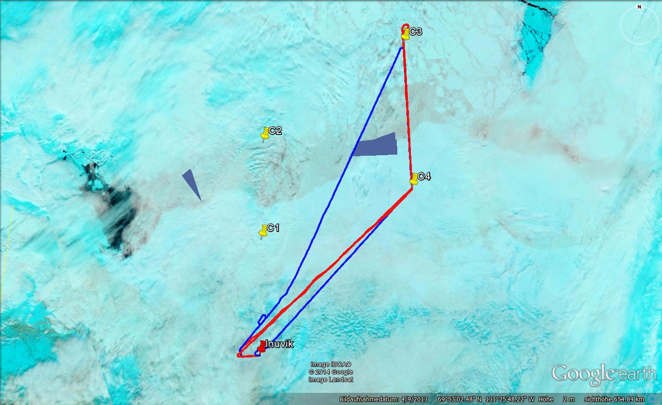
The general weather situation remained unstable. During the night another frontal system with high and midlevel clouds passed Inuvik. Low level clouds above the Beaufort Sea but unfortunately also above Inuvik remained. During the morning these clouds caused flurries in Inuvik. Therefore takeoff had to be postponed to 12 local. Later the flurries stopped and the cloud ceiling rose at the airport allowing us to fly. The planned rectangular flight pattern was skipped due to the delay and an approaching midlevel cloud band moving eastwards into the measurement area. The new plan was to fly only the easterly cloud leg but in both directions. Take-off of Polar 5 and Polar 6 was again separated about 15 min due to another aircraft landing at the same time. This was no problem for the collocation as the ferry flight was relatively long.
Polar 5 reported very good measuring conditions for remote sensing. A solid uninterrupted stratus cloud deck with 8/8 coverage at low levels was present all the time between roughly 1500 ft and 3000 ft. No high clouds were found in the measurement area. Also the measurements on the ferry with clouds above land look interesting. The cloud top altitude as identified by the lidar system showed some abrupt changes indicating changes in the characteristics of the low level clouds. On the way to the northernmost point, from C4 to C3, the cloud were very homogeneous with no visible changes except for a decreasing cloud top altitude towards north. The surface below the clouds with a mixture of open water, small and large ice flows looked interesting for our investigations. On the way back, two drop sondes were released. One above the homogeneous cloud layer above the sea. One after a change in cloud structure over land as already observed during the first passage of the clouds. Overall the wind in the area were very calm and conditions were stable. So the lidar profile showed an almost perfect symmetry for the flight in both directions.
On the way to C3, Polar 6 cruised at 4000 ft, 6000 ft and later 8000 ft altitude. Low clouds were present and a layer above the airplane. Later a haze/aerosol layer was detected by the lidar on Polar 5 which was sampled by Polar 6 during the slow descent towards cloud top zone. After C3, Polar 6 only performed two experiments: (1.) Sampling the cloud top entrainment zone in a long ''linear'' flight path for about 43 minutes, and (2.) sampling aerosol profiles in the cloud free, clear air for 100 minutes. Sampling the cloud top was done at different altitudes, once inside the cloud, once closely above cloud top. Towards the end of (1.) significant icing on aircraft and wing probes occurred (as well as at the sampling inlets) such that the aircraft could not enter the clouds afterwards anymore. So Polar 6 returned directly to Inuvik performing a long staircase for aerosol and trace gas measurements. At nine levels between 2,500 ft and 10,000 ft straight legs of about 10 minutes duration were flown. Close to 7,000 ft. a hazy layer became visible and was crossed by Polar 6.
: a.ehrlich@uni-leipzig.de
: Leipzig Institute for Meteorology (LIM), Stephanstr.3, 04103 Leipzig, Germany
![]()