| Take Off: | P5 16:29 UTC | P6 16:24 UTC |
| Touch Down: | P5 18:10 UTC | P6 18:20 UTC |
| Duration | P5 1.41 h | P6 1:56 h |
A frontal system was approaching Inuvik and the Beaufort Sea from the west. In the north-east an area with very low clouds probably fog touching the surface was forecasted and visible in the satellite images. This cloud field was predicted to disintegrate during the days. From the west a second band with low level clouds was approaching. These clouds where expected to be higher but overcast by cirrus. The flight plan intended to sample both cloud layers.
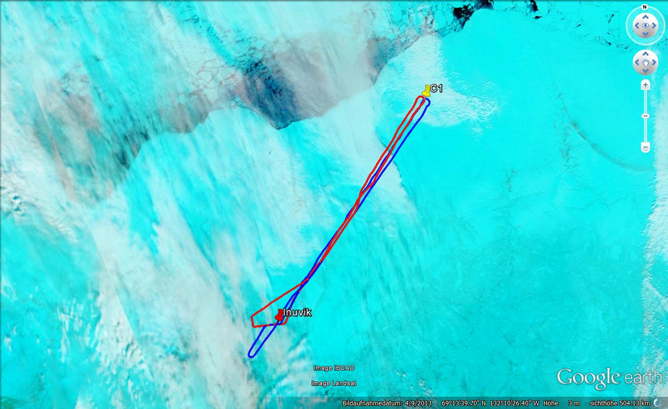
We took off around 10:30 local, after ground fog disappeared at the airport, in the direction of way point C1 hoping for an increasing cloud amount during the track. Unfortunately, after reaching our flight altitude of about 10,000 feet we experienced a variety of different cloud types on our way with mostly very shallow fog below and often inhomogeneous cirrus above. The cloud situation was quite messy, a useful analysis will be challenging. All instruments were functioning properly, the lidar was switched on short after take-off, and switched off before landing. No drop sonde was wasted for this flight. After reaching C1 it was decided to return to the airport, no useful cloud situations were expected from visible inspection of the horizon. On our way back we had a fly-by with P6.
Outbound, Polar 6 visually observed cloud layers above MacKenzie Mountains and Delta. 30 minutes before arriving at C1 jetstream type cirrus appeared above, and ground fog below. P6 was cruising at 7500 ft during outbound flight and sometimes penetrated thin veils. At C1 only ground fog was found and in coordination with P5 the leg towards north canceled. After turning at C1 a vertical profile for the trace gas experiment CO, CO2 was flown. In different steps layers between 10,000 ft and 3,000 ft were sampled. In most legs the measurements were made outside clouds in clear air. The profile was finished with the lowest leg close to Inuvik airport.
: a.ehrlich@uni-leipzig.de
: Leipzig Institute for Meteorology (LIM), Stephanstr.3, 04103 Leipzig, Germany
![]()