| Take Off: | P5 17:45 UTC | P6 17:52 UTC |
| Touch Down: | P5 20:30 UTC | P6 20:33 UTC |
| Duration | P5 2:45 h | P6 2:41 h |
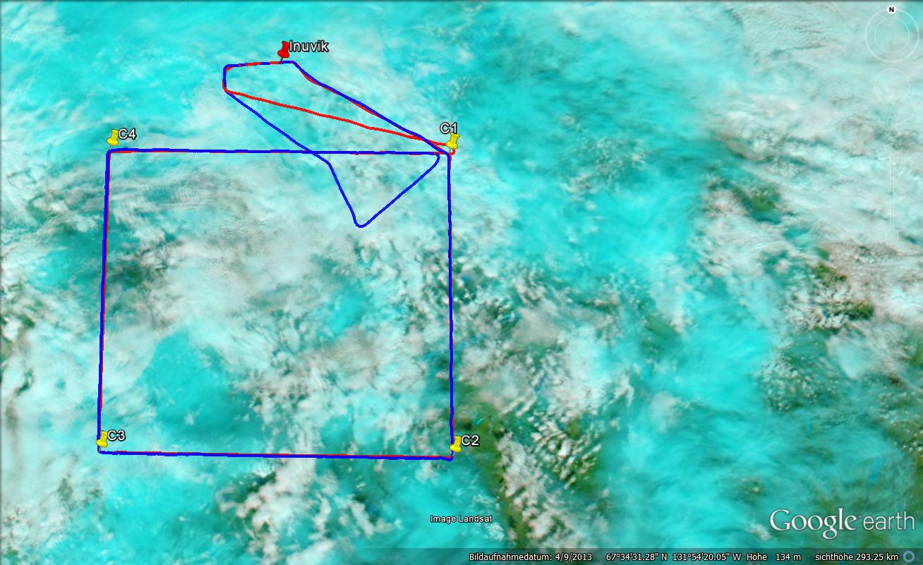
On Friday, Inuvik lay just south of a front, which was moving slowly eastwards and slightly to the south. Before the arrival of the precipitation band a wide field of midlevel clouds was predicted to develop south of Inuvik. As these clouds were in the range of Polar 6 we decided to mirror our previous flight strategy. With the higher clouds Polar 6 was still intended to fly into the clouds sampling microphysical properties but this time mostly at the cloud bottom, where precipitation can be expected. Polar 5 now does remote sensing from below. Therefore the lidar was configured for zenith measurements. Take-off again was delayed. This time not due to weather or instrumental problems but because another aircraft arriving in Inuvik had to make an emergency landing. Shortly after the save landing, Polar 5&6 started south where a rectangular pattern was flow.
On the way to the start of the rectangle, Polar 5 did fly in about 2000 ft altitude. Clouds above were already detected by AMALi. In the beginning a homogeneous cloud bottom with precipitating fall strikes were identified between 1600 m and 2400 m altitude. Reaching the measurement leg, Polar 5 adjusted the altitude to about 1,000 ft above ground. This altitude was chosen to have the best conditions for the remote sensing of the surface, which was one major objective for Polar 5 during this flight. The altitude was not changed continuously. Rather adjustments were made if higher hills appeared otherwise a constant pressure altitude was flown. Only in the beginning, the clouds were thin enough so that the sun photometer could measure properly. Later the clouds became denser with varying altitude of the lowest layer. At the south west point of the rectangle first rain drops were visible in the altitude of Polar 5. Later when flying on the final leg close to Inuvik, the rainfall intensity increased significant. With the sensitive lidar system pointing upward, we stopped the system before any water could enter the optics and electronics. Surface properties observed by Polar 5 were found to by very variable and much darker then over the Beaufort Sea. A tendency of less remaining snow and more open lakes was observable during the flight.
An the begin of the flight Polar 6 climbed up to the cloud bottom at about 7,500 ft altitude. First sampling in the precipitation zone steps into the main cloud body with enhanced cloud droplet concentration were flown. At about 10,000 ft the cloud top layer was reached and some icing observed. Later Polar 6 continued to sample the cloud bottoms. Accounting for the decreasing cloud altitude the flight levels were accordingly adjusted to about 5,000 ft. Being close to Inuvik airport, Polar 6 had to leave the cloud due to air traffic. Therefore, precipitation was sampled at different altitudes down to 1,500 ft. As rain fall increased and the cloud base further descents the last leg planned in the flight plan was skipped and Polar 6 returned together with Polar 5 to Inuvik.
: a.ehrlich@uni-leipzig.de
: Leipzig Institute for Meteorology (LIM), Stephanstr.3, 04103 Leipzig, Germany
![]()