| Take Off: | P5 19:24 UTC | P6 19:28 UTC |
| Touch Down: | P5 22:45 UTC | P6 22:30 UTC |
| Duration | P5 3:21 h | P6 3:02 h |
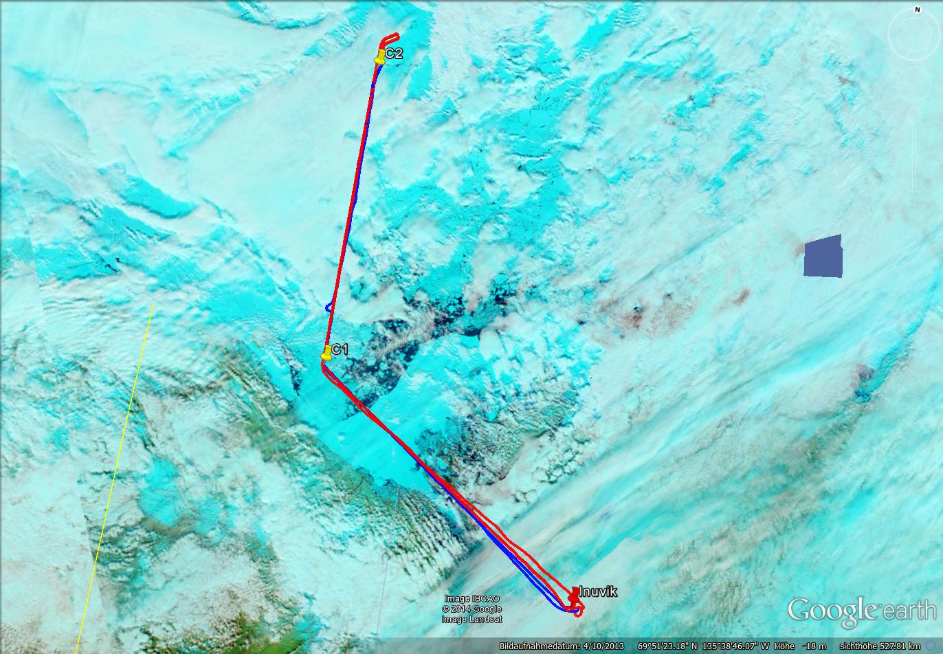
The low pressure system south east of the Mackenzie Delta remained stable. Inuvik was still at the edge of the cloud complex. Additionally a front advanced from North West. Despite the not easy to predict weather situation two flights were scheduled as before and after the passage of the front good measurement conditions were expected. The later flight was possible as the front weakened and measurements behind the front were feasible. This area was located North West of the Mackenzie Delta. Here the low level clouds were in a dissolving state as seen from the satellite images. Some cloud gaps gave the chance for Polar 6 to first approach the measuring area below the clouds and then ascending to the cloud top in a cloud gap. As the exact position of the cloud field was not to be forecasted a straight line from South to North was flown. As identified later in this area also a new more stable field of low clouds was approaching from westerly direction.
After take-off, Polar 5 first had to cross a region with bands of high cirrus clouds which reached almost until the waypoint C1. When reaching C1 and heading north into the direction of C2 conditions improved. A low level cloud layer which evolved from a more or less patchy appearance to a closed cloud layer was found. Over the whole range of the leg between C1 and C2 the radiation measurements just once have been affected by small cirrus clouds above. But most of the time clear sky was observed above Polar 5. Reaching C2 Polar 5 turned late and let Polar 6 pass for the way back. Flying the identical track back we released two drop sondes at C2 and C1 to sample the different cloud structures with closed low level cloud layer at C1 and more patchy clouds at C2. On the way back from C1 to Inuvik Polar 5 had to cross again the midlevel clouds associated with the front.
As the ferry was quite long and close to Inuvik still a lot of clouds, probably icing, were present, Polar 6 stayed below the lowest clouds as long it was necessary. Already before C1 the clouds got thinner so that they could be penetrated for in situ measurements. Later also cloud free areas were found. Inside the cloud again icing occurred. On the way to C2 after a cloud free area another cloud layer was observed. Climbing through the cloud cased again icing. Therefor Polar 6 stayed at cloud top for most of the remaining leg. Cloud top altitude was about 6,200 ft high. Dipping into the cloud top always caused icing even if the clouds looked quite thin. On the way back from C2 to C1 an aerosol profile was flown. Steps at 10,000 ft, 8,000 ft, 7,000 ft, 4,000 ft, 2,000 ft, and 1,000 ft were sampled. The cloud layer was passed again in altitudes below 6,300 ft. The ferry back to Inuvik was also flown at 1,000 ft altitude.
: a.ehrlich@uni-leipzig.de
: Leipzig Institute for Meteorology (LIM), Stephanstr.3, 04103 Leipzig, Germany
![]()